
Al-Idrisi and The book of Roger
Norman King Roger II was aware of the many contributions made by Arab in the field of science in al-Andalus, thus he decided to call the famed Andalusí geographer al-Idrisi to the court of Sicily to put him in charge of drafting the largest geographic work ever done, known as the Tabula Rogeriana.

Ceiling at the Palatial Chapel in the Normans’ Palace, built by Sicilian Muslims.
In the year 1138, the royal palace at Palermo, Sicily was the scene of a long-awaited meeting between an unusual Christian king and a distinguished Muslim scholar. As his visitor entered the hall, the king rose, took his hand and led him across the carpeted marble to a place of honor beside the throne. Almost at once the two men began to discuss the project for which the scholar had been asked to come from North Africa: the creation of the first accurate—and scientific—map of the entire known world.
The monarch was Roger II, King of Sicily; his distinguished guest, the Arab geographer al-Idrisi. Born in Ceuta, Morocco, across the strait from Spain, al-Idrisi was then in his late 30’s. After studying in Cordoba, in Muslim Spain, he had spent some years in travel, covering the length of the Mediterranean, from Lisbon to Damascus. . As a young man with poetic pretensions, he had written, as a student, verse celebrating wine and good company, but in the course of his journeys he had discovered his real passion: geography.
Imagen of King Roger II of Sicily at the Martorana,church, crowned directly by God. ©R. Doughty
The Mediterranean in the 11th and 12th centuries
Al-Idrisi’s writings tell us less about his own character and personality than about those of the man who became his host and patron. Roger II, son of a Norman-French soldier of fortune who had conquered Sicily at the beginning of the 12th century, was an anomaly among Christian monarchs of his time. . His co-religionists, commenting on his oriental lifestyle, complete with harem and eunuchs, disparagingly referred to him as the “half-heathen king” and “the baptized Sultan of Sicily.” Educated by Greek and Arab tutors, he was an intellectual with a taste for scientific inquiry, and relished the company of Muslim scholars, of whom al-Idrisi was one of the most celebrated.
Such cultural communication at a time when Crusaders and Muslims were battling in the Holy Land and while Mediterranean pirates of both faiths plundered each other’s ships and ports may seem surprising. But Crusades and piracy notwithstanding, medieval merchants did brisk business across the frontiers of religion, and inevitably ideas were exchanged as well as products.
Inscription in Arabic in columna at Martorana church (Palermo). ©R. Doughty.
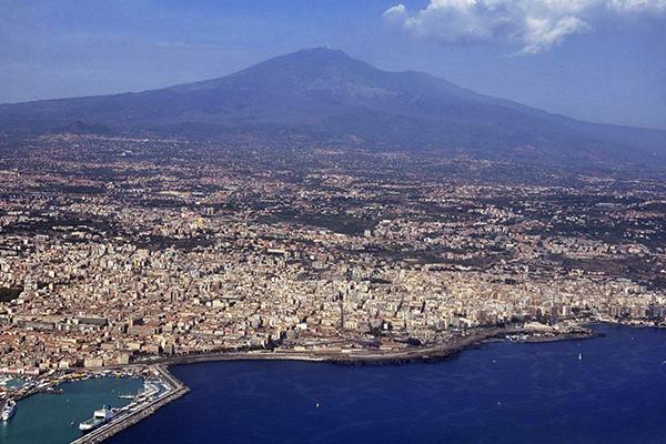
Sicily was a meeting ground for the two civilizations. Captured by the Arabs in 831, the island had remained in Muslim control until the end of the 11th century. Like Muslim Spain was a beacon of prosperity to a Europe caught in the economic slow-down we call the Dark Ages. Like Muslim Spain was a beacon of prosperity to a Europe caught in the economic slow-down we call the Dark Ages. The occupying Arabs had built dams, irrigation systems, reservoirs, and water towers, introduced new crops—oranges and lemons, cotton, date palms, rice—and exploited the island’s mines and fishing grounds.
Early in the 11th century a band of Norman adventurers, the Hautevilles, had ride into southern Italy to wrest it from the Byzantine Greeks and the Muslims, and in 1101 Count Roger d’Hauteville capped his career by conquering Sicily. Four years later, he passed the territory on to his son, Roger, who in 1130 was crowned king as Roger II.

Image of Roger II of Sicily. ©R.Doughty
Roger II and Geography
Tall, dark-haired, bearded and corpulent, Roger, from a magnificent palace in Palermo, ruled his kingdom with a balanced mixture of diplomacy, ruthlessness, wisdom and skill that has led many historians to term his kingdom the best-governed European state of the Middle Ages. His energy was a legend—one commentator remarked that Roger accomplished more asleep than other sovereigns did awake —and his court boasted a collection of philosophers, mathematicians, doctors, geographers and poets which had no superior in Europe— and in whose company he spent much of his time. “In mathematics, as in the political sphere,” al-Idrisi wrote of his patron, “the extent of his learning cannot be described. Nor is there any limit to his knowledge of the sciences, so deeply and wisely has he studied them in every particular. He is responsible for singular innovations and for marvelous inventions, such as no prince has ever before realized.”
Roger’s interest in geography was the expression of a scientific curiosity just awakening in Europe, but inevitably he turned to a Muslim for help. Christian Europe’s approach to map-making was still symbolic and fanciful, based on tradition and myth rather than scientific investigation, and used to illustrate books of pilgrimage, Biblical exegesis, and other works. Picturesque and colorful, European maps showed a circular earth composed of three continents equal in size—Asia, Africa, and Europe—separated by narrow bands of water. The Garden of Eden and Paradise were at the top and Jerusalem at the center, while fabulous monsters occupied the unexplored regions —Sirens, dragons, men with dogs’ heads, men with feet shaped like umbrellas with which they protected themselves from the sun while lying down—.
A few practical maps did exist—mariners’ charts showing coastlines, capes, bays, shallows, ports of call and watering and provisioning places—but in a typical medieval divorce of science and technology, these remained in the hands of navigators. Information from travelers, too, filtered only very slowly onto Christian maps. What King Roger had in mind, therefore, was something as factual as the mariners’ charts, but encompassing the whole known world. The mission he entrusted to al-Idrisi was intellectually Herculean: to collect and evaluate all available geographical knowledge —from books and from on-the-spot observers— and to organize it into an accurate and meaningful representation of the world. His purpose was partly practical, but mostly scientific: to produce a work which would sum up all the contemporary knowledge of the physical world.
To carry out the project, Roger established an academy of geographers, with himself as director and al-Idrisi as permanent secretary, to gather and sift information. He wanted to know the precise conditions of every area under his rule, and of the world outside—its boundaries, climate, roads, the rivers that watered its lands, the seas that bathed its coasts.
The academy began by studying and comparing the works of previous geographers—principal among them 12 scholars, 10 of them from the Muslim world.
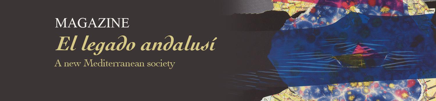
Coin known as Tari aureo, with inscriptions in Arabic, coined by Kong Roger II.
The geographical charts as an instrument
The reason behind the Muslim domination of the field of geography was simple: economics. While medieval Europe had become fragmented and parochial, both politically and commercially, the Muslim world was unified by a flourishing long-distance commerce as well as by religion and culture. Muslim merchants, pilgrims and officials used so-called “road books,” itineraries that described routes, traveling conditions and cities along the way. Some of the early authors of road books were on al-Idrisi’s list: Ibn Khurdadhbih, an eighth-century Persian who was director of the postal and intelligence service in Iran; al-Yaqubi, an Armenian who in the ninth century wrote a Book of Countries; Qudamah, a 10th-century Christian who had embraced Islam, served as a tax accountant at Baghdad and written a book discussing the postal and tax systems of the Abbasid Caliphate. Others belonged to a later tradition of systematic geography, like the 10th-century scholars Ibn Hawqal and al-Mas’udi, who produced books intended as something more than practical guides for the tax collector or the postman: as additions to the fund of human knowledge.
Al-Idrisi’s two geographers from the pre-Islamic era were Paulus Orosius, a Spaniard whose popular History, written in the fifth century, included a volume of descriptive geography; and Ptolemy, the greatest of the classical geographers, whose Geography written in the second century, had been entirely lost to Europe, but preserved in the Muslim world in an Arabic translation.
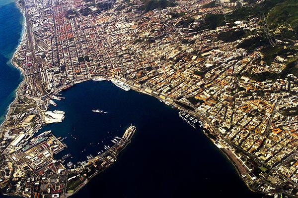
After examining at length, the geographical works, they had collected, the king and the geographer observed that they were full of discrepancies and omissions and decided to embark on original research. Sicily’s busy and cosmopolitan ports provided an ideal place for such an inquiry, and for years hardly a ship docked at Palermo, Messina, Catania or Syracuse without its crew and passengers being interrogated about the places they had visited. The commission’s agents haunted the ports, and if they discovered a traveler who had visited any particularly exotic region, he was conducted to the palace at Palermo to be questioned by al-Idrisi or even by Roger. What was the climate of the country, its rivers and lakes, mountains, coastal configurations, and soil? What of its roads, buildings, monuments, crops, crafts, imports, exports, and marvels? What of its roads, buildings, monuments, crops, crafts, imports, exports, and marvels? What, finally, were its culture, religion, customs, and language? In addition, scientific expeditions were dispatched to areas on which information was lacking. These expeditions were accompanied by draftsmen and cartographers so that a visual record of the country could be made.
During this research, al-Idrisi and Roger compared data, keeping the facts on which travelers agreed and throwing out all conflicting information. This process of collecting and assessing material took 15 years, during which, according to al-Idrisi, hardly a day passed when the king did not confer personally with the geographers, studying accounts that disagreed, examining astronomical coordinates, tables, and itineraries, poring over books and weighing divergent opinions.
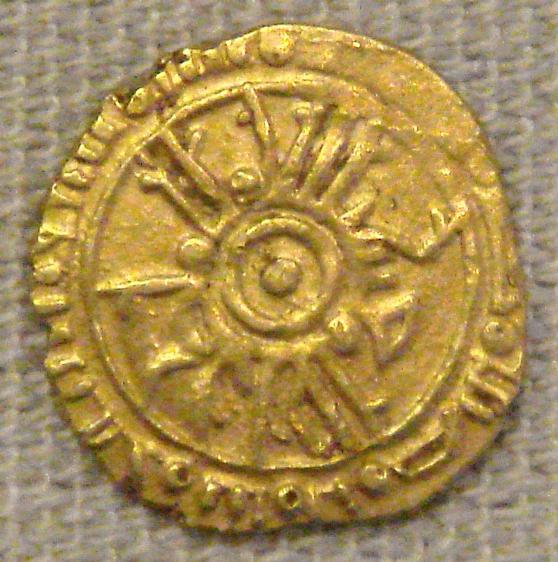
Port of Siracusa.
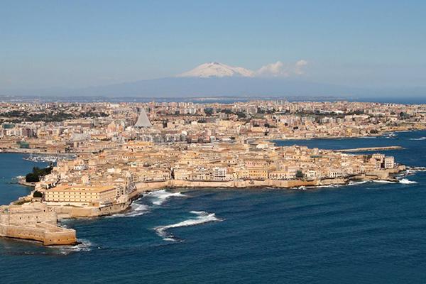
Port of Palermo.
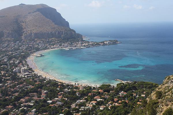
Port of Catania.
Port of Messina.
The Sicilian ports of Palermo, Messina, Catania or Syracuse (from left to right) were the main source to collect the information needed by al-Idrisi and king Roger for a work this size.
Al-Idrisi’s great work
Finally, however, the long preliminary study was finished and the task of map making began. First, under al-Idrisi’s direction, a working copy was produced on a drawing board, with places sited on the map with compasses, following the tables that had already been prepared. Then a great disk almost 80 inches in diameter and weighing over 300 pounds was fabricated out of silver, chosen for its malleability and permanence.
Al-Idrisi explained that the disk merely symbolized the shape of the world: “The earth is round like a sphere, and the waters adhere to it and are maintained on it through natural equilibrium which suffers no variation.” It remained “stable in space like the yolk in an egg. Air surrounds it on all sides…. All creatures are stable on the surface of the earth, the air attracting what is light, the earth what is heavy, as the magnet attracts iron.”
As his comment suggests, al-Idrisi thought that the world was round. Nor was he alone. Contrary to a still popular misconception that up to the time of Columbus everyone believed the world was flat, many scholars and astronomers since at least the fifth century B.C. had believed that the earth was a globe.
In the third century B.C. the Alexandrian astronomer Eratosthenes measured a degree of the earth’s circumference with amazing accuracy, arriving at a figure with an error of either 1.7 or 3.1 percent. (The variation in the amount of his error is due to modern uncertainty as to the exact length of the measurement he used.) Ptolemy, four centuries later, estimated the circumference with much less success —at almost 30 percent less than its true extent—. And in the ninth century, 70 Muslim scholars, working under the patronage of Caliph al-Ma’mun, gathered in the Syrian Desert to determine the length of a degree of latitude. Rather than rely on travelers’ guesses of distance, as previous astronomers had done, they used wooden rods to measure the road they traveled until they saw a change of one degree in the elevation of the polestar. Their calculation resulted in a figure for the earth’s circumference equivalent to 22,422 miles, an error of 3.6 percent, almost as accurate as Eratosthenes’ estimate and a considerable improvement over Ptolemy’s.

Al-Idrisi map of the world.
By al-Idrisi’s time, Muslim astronomers had made great strides in methods of reckoning latitude. (Longitude remained a problem until the 17th century.) Arab geographers had corrected some of the errors of Ptolemy and other Greek scientists. The mathematician al-Khwarizmi reduced Ptolemy’s estimate of the length of the Mediterranean Sea from 62 to 52 degrees; the Spanish Muslim astronomer al-Zarqali further adjusted the figure to the correct 42. Other Muslim scholars, like the Iraqi astronomer al-Battani and the Persian al-Biruni, composed tables giving the latitudes of leading cities.
Al-Idrisi himself gave three figures for the earth’s circumference, without deciding among them: Eratosthenes’ approximately correct estimate, a slightly smaller figure arrived at by Indian astronomers, and a still smaller number—though larger than Ptolemy’s—which was apparently agreed on by Sicilian scholars.
Cartography, nevertheless, remained in a primitive state. Although Ptolemy had discussed several kinds of projection, the problem of flattening out the surface of a sphere so that it could be represented on a map was not solved until the 16th and 17th centuries—the Age of Exploration—and none too satisfactorily even then. The great geographer Gerardus Mercator commented, “If you wish to sail from one port to another, here is a chart… and if you follow it carefully you will certainly arrive at your port of destination… You may get there sooner, or you may not get there as soon as you expected, but you will certainly get there.” Al-Idrisi’s silver disk or “planisphere,” was a form of projection considerably in advance of others of its time.

Image of Al-Idrisi’s map of the Mediterranean area, where he placed the African continent at the north, and Europe at the south.
On the disk, according to al-Idrisi’s own account, were incised “by skillful workers” lines marking the limits of the seven climates of the habitable world, arbitrary divisions established by Ptolemy running east and west and bounded by parallels of latitude, from the Arctic to the Equator. Below the Equator, an unexplored southern temperate zone was thought to be separated from the familiar northern one by an impassable area of deadly heat. Following the rough sketch prepared by al-Idrisi, the silversmiths transferred the outlines of countries, oceans, rivers, gulfs, peninsulas and islands to the planisphere.
To accompany the silver map, al-Idrisi prepared for Roger a book containing the information gathered by the geographers: Nuzhat al-Mushtaq fi Ikhtiraq al-Afaq (The Delight of One Who Wishes to Traverse the Regions of the World), or more simply, al-Kitab al-Rujari (Roger’s Book). The text contained 71-part maps, a world map and 70 sectional itinerary maps, representing the seven climates, each divided longitudinally into 10 sections.
Modern geographers have attempted to reconstruct the features of the silver planisphere by using a combination of the maps of Roger’s Book, which has survived in several texts, and its tables of longitudes and latitudes. From this reconstruction it is evident that, like Ptolemy, al-Idrisi pictured the habitable world as occupying 180 of the 360 degrees of the world’s longitude, from the Atlantic in the West to China in the East, and 64 degrees of its latitude, from the Arctic Ocean to the Equator. The planisphere showed the sources of the Nile—not explored by Europeans until the 19th century, but evidently known to 12th-century Muslim travelers—and the cities of central Sudan. The Baltic area and Poland were represented much more precisely than on Ptolemy’s maps, showing the fruit of the geographers’ investigations. The British Isles also were treated with a surprising knowledgeability, probably due to contacts between Norman England and Norman Sicily. An element of subjectivity entered into the fact that southern Italy was represented as larger than the north, and that Sicily occupied a substantial part of the Western Mediterranean, in contrast to Sardinia and Corsica, which shrank in scale. Not surprisingly, the best part of both map and text, accurate and detailed, dealt with Sicily itself.
Distortions, omissions, and misconceptions notwithstanding, the superiority of al-Idrisi’s map over the world maps of medieval Europe is striking. Contrasted with the quaint and picturesque, but almost totally uninformative maps of the Christian scholars, the features of Europe, North Africa and the Middle East are easily recognizable in al-Idrisi’s representation—Britain, Ireland, Spain, Italy, the Red Sea and the Nile.


Decorative motifs of the Arab-Normand constructions showing the interlocking of styles because of the cultural mix in the Mediterranean island.
The Book of Roger
The book that accompanied the great silver planisphere was even more remarkable. The first medieval “general geography,” and the most elaborate description of the world produced in the Middle Ages, Roger’s Bookundertook a stupendous task, that of systematically describing the habitable world, beginning with the first section of the first climate at Ptolemy’s prime meridian, the Canary Islands. It proceeded from west to east and from south to north through each of the 10 sections of the seven climates. Each section opened with a general description of the region, then a list of the principal cities, then a detailed account of each city, with distances between cities: “From Fez to Ceuta, on the Strait of Gibraltar, heading north, seven days. From Fez to Tlemcen, nine days, following this itinerary: from Fez turn toward the great river of Sebou…”
The first division of the first climate began in the Western Sea, the “Sea of Darkness.” “In this sea are two islands named the Fortunate Isles…Nobody knows of habitable land beyond that.” To the south al-Idrisi pictured a great river, the “Nile of the Negroes,” a composite of the Senegal and the Niger, that flowed from Central Africa west to the Atlantic. Via this river the salt trade was carried on with the Sudan. Al-Idrisi described the lost city of Ghana (near Timbuktu, on the Niger) as “the most considerable, the most densely peopled, and the largest trading center of the Negro countries.” In the fourth section of the first climate, al-Idrisi located the sources of the Nile in their approximately correct position, though he pictured the “Nile of the Negroes” as joining the “Egyptian Nile” at that point.
Al-Idrisi gave a detailed description of Spain, where he had spent his student days. He praised Toledo, with its defensible site, fine walls and well-fortified citadel. “Few cities are comparable in the solidity and height of buildings, the beauty of the surrounding country, and the fertility of the lands watered by the Tagus.” “The gardens of Toledo are laced with canals on which are erected water wheels used in irrigating the orchards, which produce in prodigious quantity fruits of inexpressible beauty and quality. On every side are fine estates and well-fortified castles.”

Manuscript of the description of Findand.
Every area had its fascinations. In Russia, winter daylight periods were so short that there was hardly time for Muslim travelers to perform all five obligatory daily prayers. The Norwegians had to harvest their grain when it was still green and dry it at their hearths “since the sun shines very rarely upon them.” As for Britain, it “is set in the Sea of Darkness. It is a considerable island, whose shape is that of the head of an ostrich, and where there are flourishing towns, high mountains, great rivers and plains. This country is most fertile; its inhabitants are brave, active and enterprising, but all is in the grip of perpetual winter. ” Al-Idrisi gave the names of many English towns, principally ports, with the distances between them. Hastings was a “considerable town, densely populated, with many buildings, markets, much industry and commerce;” Dover, to the east, was “an equally important town” not far from the mouth of the “river of London, the broad and swiftly flowing Thames.” London, however, was mentioned only as “a city of the interior.”
Towns of France were also described, again with emphasis on the ports, particularly those of Britanny and Normandy; but cities of the interior were also listed: Tours, then, as now, a wine center “surrounded by numerous vineyards;” Chartres, an agricultural market (its famous cathedral had not yet been built); Meaux, “the center of the land of France;” Bayeux, Dijon, Troyes, Orleans, Le Mans and many others. Paris (Abariz) earned a condescending reference as a town “of mediocre size, surrounded by vineyards and forests, situated on an island in the Seine, which surrounds it on all sides;” however, “it is extremely agreeable, strong, and susceptible of defense.”
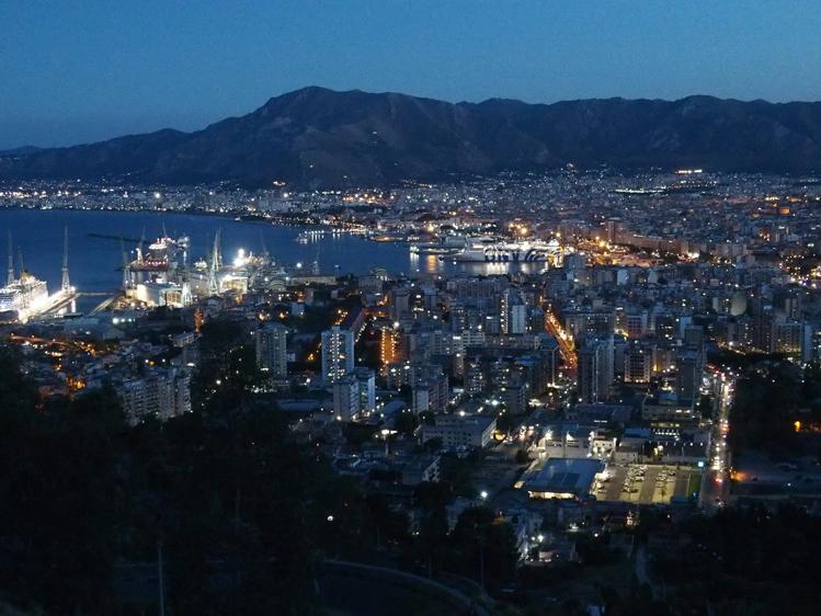
Present port of Palermo by night. ©R. Doughty
Sicily, naturally, came in for special praise; it was “a pearl of the age,” and al-Idrisi told the story of the Norman conquest of the island by Roger d’Hauteville, “the greatest of Frankish princes,” followed by the succession of “the great king who bears the same name and who follows in his footsteps.”
The impressive assemblage of facts from travelers’ accounts and geographical writings was interrupted now and then by fables, some taken directly from Ptolemy, some from popular folklore. The Strait of Gibraltar, according to Roger’s Book, did not exist when Alexander the Great—as medieval legend had it—invaded Spain. Because the inhabitants of Africa and Europe waged continual warfare, Alexander decided to separate them by a canal, which he cut between Tangier and al-Andalus (southern Spain). The Atlantic rushed in, inundating the land and raising the level of the Mediterranean.
Al-Idrisi’s Rome had an oriental magnificence; ships with their freight sailed up the Tiber to be “drawn thus loaded right up to the very shops of the merchants.” There were 1,200 churches; the streets were paved with blue and white marble; in a magnificent church encrusted with emeralds stood an altar supported by 12 statues of pure gold, with ruby eyes. And the city’s “prince,” he wrote, “is called the Pope.”
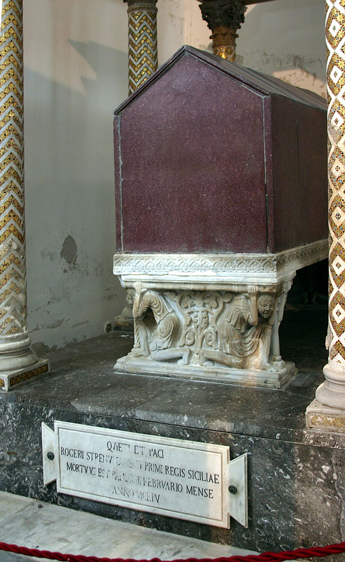
he tumb of Roger II at the Catedral of Palermo.
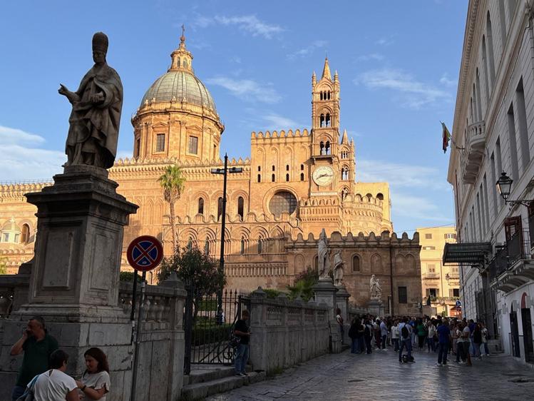
Catedral of Palermo
Al-Idrisi presented the planisphere, a silver celestial sphere and the book to his patron in 1154, just a few weeks before Roger died at 58, probably of a heart attack; he went on to compose another geographical work for William I, Roger’s successor. This work is said to have been even more extensive than his earlier one, but only a few extracts have survived.
In 1160, however, Sicilian barons rose in rebellion against William and during the disorders looted the palace; in a great fire in the courtyard, they burned government records, books and documents—including a new Latin edition of Roger’s book which al-Idrisi had presented to William. At the same time, the silver planisphere and celestial sphere disappeared, apparently cut up and melted down.
Since the barons had attacked the Muslims of Sicily with particular ferocity—killing, among many others, a famous poet named Yahya ibn al-Tifashi—al-Idrisi fled to North Africa where, six years later, he died.
As he had brought the Arabic text with him, however, his great work lived on, winning widespread fame, serving as a model for Muslim geographers and historians for centuries and providing the great Muslim historian, Ibn Khaldun, with practically all his geographical knowledge.
It was not, however, available in Europe. Although the Arabic text of Roger’s Book was published in Rome by the Medici press in 1592, it was not again available to Europeans in Latin until the 17th century. In the 1400’s, therefore, Christopher Columbus had to rely on other sources of information. Using a globe prepared by a German cartographer named Martin Behaim—based on Ptolemy’s miscalculations— Columbus also added in Marco Polo’s equally misleading estimates of distances and concluded, incorrectly, that by sailing west from Spain he could reach Japan or India after no more than a 4,000-mile voyage.
It is a curious thought that had Columbus been aware of the true distance—from al-Idrisi’s estimates—he might have hesitated to undertake his epoch-making voyage and might never have discovered that new world which came to light one morning on the far side of the “Sea of Darkness.”